
How erosion models are busting gullies, predicting the future and helping miners design landforms that last centuries and pass the pub test

, , , , , , , , , , , , , , , , , ,
, ,
, , ,
What if you could fast-forward a century to see whether your rehabilitated mine landform holds its shape or collapses into a network of gullies?
At a recent seminar hosted by the Office of the Queensland Mine Rehabilitation Commissioner (OQMRC), one message rang clear: erosion and landscape evolution models are no longer just academic exercises—they’re digital crystal balls for mine closure planning.
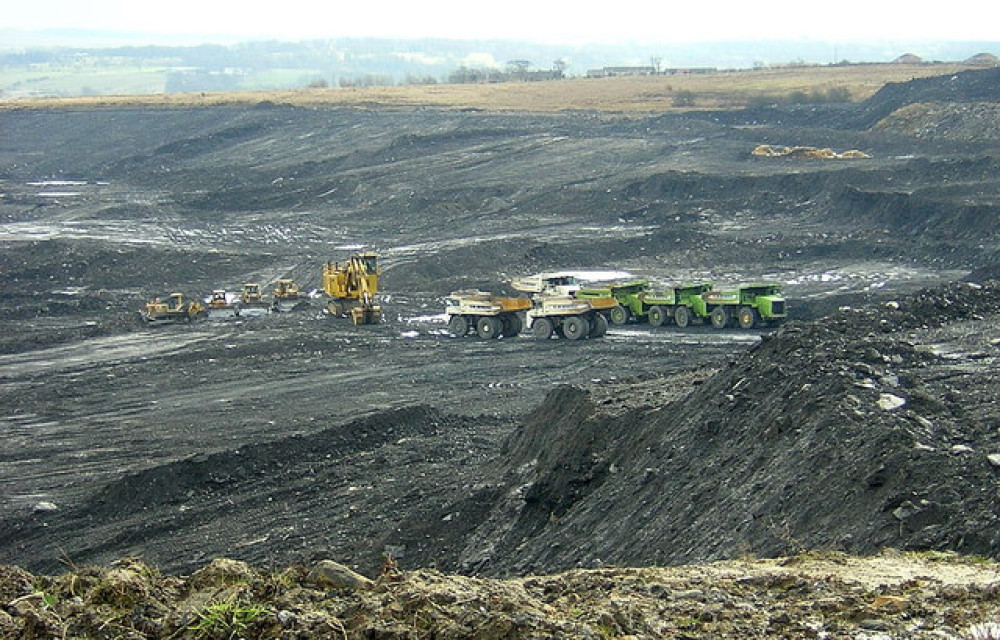
Across Queensland, these models are fast becoming essential tools for mine operators under pressure to prove their final landforms will remain stable for decades—if not centuries—after operations cease. With regulators and researchers aligned, the push is on for better ways to predict gully formation, minimise long-term environmental risks, and build landscapes that endure.
Why Erosion Models Matter
"The stability of final landforms is a foundational aspect that underpins the success of rehabilitation," said Louisa Nicolson, Lead Technical Advisor at the Office of the Queensland Mine Rehabilitation Commissioner (OQMRC), in her opening remarks. In Queensland, mine operators must demonstrate the long-term stability of their final landform designs, as required by the Progressive Rehabilitation and Closure Plan (PRCP) framework.
"We realised here at the office that it would be important for us to contribute to the discussion by providing some information on the use of erosion and landscape evolution models in landform design processes," Louisa said.
The seminar centred on a foundational technical paper authored by Associate Professor Greg Hancock of the University of Newcastle, a recognised expert in soil erosion and landscape rehabilitation modelling. Greg provided an overview of three main types of erosion models commonly used in mining: the Revised Universal Soil Loss Equation (RUSLE), the Water Erosion Prediction Project (WEPP), and more complex Landscape Evolution Models (LEMs) such as SIBERIA, CAESAR-Lisflood, and the emerging SPAM model.
Also joining the panel was Tim Nash, an experienced environmental and soil scientist with 16 years in environmental management, including work in the coal and coal seam gas sectors. Tim specialises in erosion and sediment control, revegetation, and the application of erosion models in both consulting and government contexts.
Understanding the Models
Greg explained that each model type has its own strengths, weaknesses, and appropriate use cases. RUSLE, for example, is a relatively simple model that predicts annual soil loss at the base of a slope based on rainfall erosivity, soil erodibility, slope length and angle, and vegetation cover. "It’s ideal for hill slope design," Greg said. "You can use it in a spreadsheet to test different vegetation cover strategies and slope configurations."
WEPP builds on the RUSLE framework by allowing users to model sediment transport across multiple linked slopes and include more detailed hydrological, climatic, and vegetation interactions. Still, as Greg noted, both RUSLE and WEPP are limited: "They will only provide you information on tonnes per hectare per year. They will not give you any information on gullying."
In contrast, LEMs simulate both erosion and deposition by evolving a digital elevation model (DEM) over time. These models can predict not just rates of erosion but also the location, depth, and progression of features such as gullies and deposition fans. "Landscape evolution models actively evolve a landform," said Greg. "They provide a really good tool for high-risk assessments of designs."
A Case Study in Predictive Power
One striking example shared by Greg involved a 200-metre-long, 20% slope in central Queensland. The model, parameterised with site-specific data, predicted severe gully development within ten years and catastrophic landform degradation by 100 years. "We validated these results against the site at around 14 years, and we’re reasonably confident that this landscape is going to go down this route of a highly gullied landform," he said. This highlighted the value of using such models not just to justify designs, but to improve them.
The Importance of Inputs
According to Greg, model accuracy depends heavily on input quality. Two of the biggest failure points he sees are poorly constructed DEMs and the use of generic or inappropriate parameter values.
"If your DEM doesn't have breaks in slope like benches or contour drains, the model won’t see them," he warned. "The runoff will just travel downslope in the steepest direction, causing erosion that may not occur in reality."
Tim agreed. "A lot of failures you see stem from a lack of clarity of purpose. Why are you modelling? What are you trying to manage?" he said. "A genuine effort to optimise is a good outcome, rather than to legitimise."
This iterative approach—testing designs, refining them, collecting field data, and feeding it back into the model—was emphasised throughout the discussion. Tim also noted that the level of modelling effort should match the level of environmental risk: "If you're encapsulating tailings, a higher level of effort is warranted."
Gullies and Vegetation: Ongoing Challenges
Gully erosion, in particular, emerged as a recurring concern. Greg showed how the SIBERIA model could predict the location and progression of gullies on waste rock dumps and highlighted the importance of capturing such features during design.
Vegetation, too, plays a critical role. "Some recent work of mine has found a 140-fold reduction in erosion with vegetation," Greg said. However, he cautioned that vegetation cover is dynamic and influenced by factors such as drought and soil quality.
"The problem comes when you can’t establish vegetation, or you’ve got suboptimal materials that support growth initially but not over the long term," he said.
How Long Should We Model?
A common question during the seminar was: how far into the future should erosion models predict? Tim noted that 100 years is a standard timeframe, balancing confidence with realism. "Anything beyond that, you run into a lot of uncertainty around climate," he said.
Greg concurred: "I think we’re pretty good out to 100 years with good data. Beyond that, who really knows? But given that our climate models are only predicting out to about 90 years, that’s probably reasonable."
Regulatory Implications and Forward Outlook
The seminar also touched on the role of new and emerging models, and the need for rigorous validation. Greg said it takes three to five years to gain confidence in a new model’s predictions. He encouraged innovation but stressed that models must be fit for purpose and appropriately tested.
As Louisa summarised: "Using these models does require a level of technical ability, and we hope we’ve presented to you today some of the pros and cons for different models and how you should consider the inputs."
She concluded with a reminder that a well-designed landform is critical not only for regulatory closure but also for reducing the long-term cost and liability of rehabilitation: "We want people to be able to set themselves up for the best chance of success with their final landform."
For the mining industry, this means moving beyond box-ticking exercises and towards a truly integrated design and monitoring process. When done right, modelling offers more than a prediction: it offers a path to defensible, sustainable post-mining landscapes.