
No more blind spots: how explorers are finding buried data, busting silos, and ditching surveys thanks to smarter workflows and sharper metadata

, , , , , , , , ,
, , ,
Gem Midgley, principal consultant at Mira Geoscience, knows a thing or two about the practicalities of integrating complex geoscientific data. With more than 25 years' experience in minerals exploration, geoscience research, and consulting, she brings a multidisciplinary perspective to one of the industry’s most pressing challenges: turning large, disparate datasets into actionable insight.
"Exploration teams today are still grappling with the same problem we’ve had for years: scattered datasets," Gem explains to The Rock Wrangler. "Whether you're in a major company or a junior, you're dealing with specialist data types in a variety of formats - some proprietary - and the added complexity of multiple spatial and temporal scales."

From continental-scale area selection to mine-scale brownfield extensions, the data landscape is vast and varied. But what really compounds the problem, according to Gem, is metadata - or lack thereof. "It’s often the most boring part of the dataset," she laughed, "but it’s also the most important. Without good metadata, you can’t properly assess or reprocess the data. And that’s a big issue when teams are revisiting old ground or acquiring new tenure."
A platform built for practical integration
Mira Geoscience's platform addresses these challenges head-on through a modular suite of tools: Geoscience ANALYST for multidisciplinary data visualisation, backed by 4D data management in Geoscience INTEGRATOR.
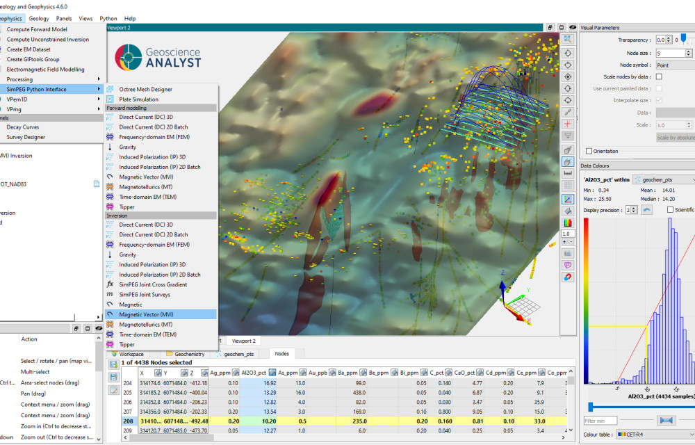
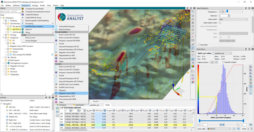
"Geoscience ANALYST is designed to be non-prescriptive," explained Gem. "It lets you import just about any geoscience dataset - geological, geophysical, geochemical, structural, even hydrogeological and geometallurgical - at multiple scales, from regional surveys to drillhole data."
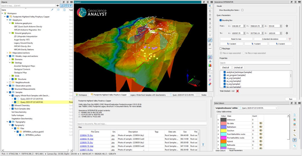
As a complement, Geoscience INTEGRATOR acts as a centralised hub for validated, version-controlled data. "It’s where all that valuable unstructured data lives - images, well logs, reports with critical metadata," said Gem. "That’s the stuff you need to make your interpretations more accurate and your workflows more efficient."
Together, these tools allow users to integrate datasets that previously lived in different departments or databases. As Gem put it, "It’s about unifying everything so geoscientists can work in one cohesive, integrated space."
Breaking down silos to avoid duplication and enable better decisions
In one recent example, a large client was preparing to conduct a new survey. The exploration team believed they lacked sufficient data for their area of interest. But after pulling all available datasets into Mira Geoscience’s platform, a different picture emerged.
"They found the exact data they thought they were missing," Gem recalled. "But it wasn’t with exploration - it was held by the hydrogeology and geotechnical teams. The data was there all along, just siloed."
By surfacing this hidden information, the team avoided unnecessary survey costs, while also improving cross-departmental collaboration. "Once everyone could see the same data in a shared 3D environment, it facilitated earlier conversations and more stakeholder buy-in. That learning changed the way the company managed exploration data going forward."
Handling structural complexity and driving undercover targeting
Mira Geoscience’s GOCAD Mining Suite - built on the established GOCAD engine - is another powerful software application for explicit and implicit 3D geological modelling, including complex structural environments and robust geostatistical property modelling.
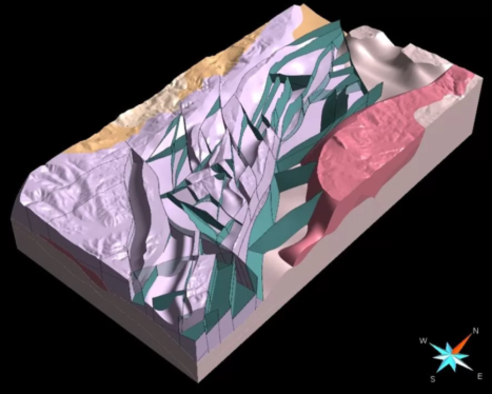
"If you’re dealing with overturned folds, repeat thrust faults, or folded structures, GOCAD can model that in a way that other platforms often can’t," said Gem. "And for sectors like coal, where complex geometry directly impacts run-of-mine calculations, that can translate to significant savings."
Geoscience ANALYST is an inherent 3D environment, supporting the exploration industry’s requirement to search undercover - a growing focus as shallow targets become increasingly rare.
"You can’t just rely on 2D plan-view data anymore," said Gem. "Our clients are using Geoscience ANALYST to bring in public, precompetitive datasets and visualise them in 3D, even at the early tenement selection stage. That’s especially valuable for juniors without big software budgets."
Empowering AI and user-defined workflows
Mira Geoscience also supports the integration of AI and machine learning into geoscientific workflows - but Gem cautioned against expecting a magic bullet.
"AI is great for removing mundane tasks and streamlining processes, like reloading legacy data or standardising logging codes across a historic dataset," she said. "But it only works if the input data are good and appropriate methodologies are applied by a subject matter expert. You need validation, version control, and a structured workflow."
To that end, Geoscience INTEGRATOR enables automated data pipelines that feed validated datasets into AI models. Users can even build their own tools, thanks to Mira’s commitment to openness and customisation.
"Our API is fully documented, and our platform is based on the GEOH5 open format," said Gem. "We support Python scripting, integration with commercial and open-source tools, and the FAIR (Findable, Accessible, Interoperable, Reusable) data principles. Flexibility is at the core of everything we do."
Collaboration, scalability, and industry feedback
Scalability is another advantage. "We get a lot of feedback from juniors and consultants who work across multiple joint-venture partners or stakeholders," said Gem. "With Geoscience ANALYST, you’re not just sending screenshots of a geophysical inversion, you can share actual datasets using our free viewer, enabling true collaboration."
The system's ease of use has also been widely praised. "Exploration geologists have to be generalists these days. Budgets don’t allow for dedicated geochemists and geophysicists on every team. So, we made it as simple as drag-and-drop," she added. "It even recognises coordinate reference systems and file types automatically."
With Geoscience INTEGRATOR acting as a searchable 4D database, users can query by time domain as well as spatial criteria. "You can ask it to show all data from the past five years or look specifically for legacy datasets, along with common category search functions. That’s a game-changer for discovery workflows."
Training, support, and industry partnerships
Gem noted that Mira Geoscience offers tailored onboarding, an in-platform support portal, and access to technical specialists with real-world consulting experience. "We also run webinars, contribute to GitHub, and support industry associations through local mentorship and academic licensing programs."
Notably, Mira Geoscience maintains active R&D through industry consortia. "Our software platform roadmap is shaped by real industry needs, not just what we think is cool to build," Gem said. "Through our Geoscience ANALYST Pro Geophysics and Pro Geology consortia, we collaborate with research organisations and major mining companies to prioritise functionality that solves real problems."
And for clients with specific needs? "We offer accelerated development - you get early access to features, and they later become part of the broader product suite," she explained.
Looking ahead
So, what’s next? Mira Geoscience is currently advancing an AI-assisted interpretation toolkit within Geoscience ANALYST Pro Geology. "This is about delivering on what geologists have been asking for - modelling and interpretation tools built into the platform itself."
For Gem, the goal remains clear: to reduce the friction in exploration workflows and help teams make better decisions, faster.
"We’re not just about building software," she concluded. "We’re about helping geoscientists do their best work by giving them tools that are flexible, open, and built for the way they think and work. That’s where the real value is."